Trail Walking Jarzé Villages - gpx-trace - Photo
© OpenStreetMap contributors
Length
Length
13.4 km
Max alt
Max alt
77 m
Uphill gradient
Uphill gradient
137 m
Km-Effort
Km-Effort  
15.2 km
Min alt
Min alt
40 m
Downhill gradient
Downhill gradient
135 m
Boucle
Boucle
Yes
Creation date :
2022-02-25 11:09:41.748
Updated on :
2022-02-25 11:11:11.172

(1 Reviews)

Walking
Walking
3h27
Difficulty : Difficult

Scan this QR Code to open this trail in the SityTrail application

FREE GPS app for hiking

Logo SityTrail SityTrail

IGN / Geographical institutes

Download SityTrail from the App Store Download SityTrail from Google Play

Logo SityTrail SityTrail World

The world is yours!

Download SityTrail from the App Store Download SityTrail from Google Play Download SityTrail on Huawei AppGallery

About

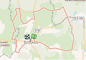
Trail Walking of 13.4 km to be discovered at Pays de la Loire, Maine-et-Loire, Jarzé Villages. This trail is proposed by bubuserge.

Elevation profile

Positioning

Country:
France
Region :
Pays de la Loire
Department/Province :
Maine-et-Loire
Municipality :
Jarzé Villages
Location:
Unknown
Start:(UTM)
706328 ; 5273252 (30T) N.

Comments

Please log in to post a review or rate the element


Belle randonnée 2km de macadam à la fin


Trails nearby

Trail Walking Montigné-lès-Rairies - randogps49-192 - Photo
Walking
bubuserge

Walking

Difficult
(1)
Montigné-lès-Rairies, Pays de la Loire, Maine-et-Loire, France
11.3 km | 12.6 km-effort
2h 46min
Yes
Trail Walking Jarzé Villages - randogps49-231 - Photo
Walking
bubuserge

Walking

Difficult
Jarzé Villages, Pays de la Loire, Maine-et-Loire, France
13.4 km | 15.2 km-effort
3h 21min
Yes


Close
My subscriptions